PUBLISHED HISTORICAL E-ATLASES
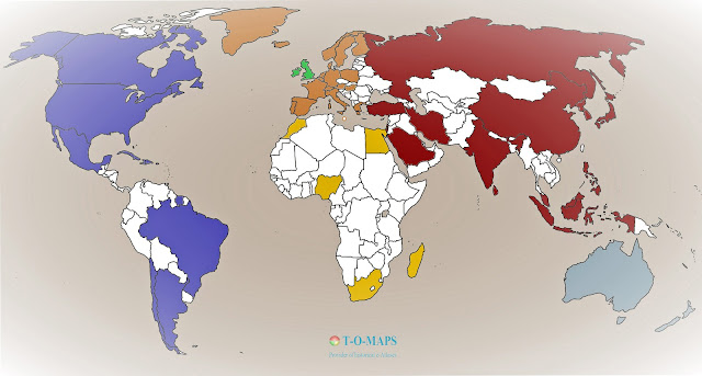
Overview map published e-atlases
(b. 2020)
Countries:
Argentina/Chile Australia Austria Brazil Canada China Cuba Denmark Egypt England
France Germany Greece Greenland Hungary Iceland India Iran Ireland Israel Italy Japan
Korea Luxemburg Madagascar Malta Mexico Morocco Netherlands/Belgium*
New Zealand Nigeria Poland Portugal Russia Saudi Arabia Scandinavia Scotland
South-Africa Southeast-Asia Spain Sri Lanka Surinam Switzerland Turkey Ukraine
United Kingdom USA Wales.
* With Brussels as the HQ of the European Union (EU)
Continents:
Africa in 50 historical maps: 40AD-2018
Asia in 50 historical maps: 20BC-2018
Europe in 50 historical maps: 150AD-2020
North America in 50 historical maps: 1502-2018
South America in 50 historical maps: 1507-2018
Historical e-atlas Pacific: 1527-2018
World:
The world in 50 historical maps: 20BC-2020
🗺

